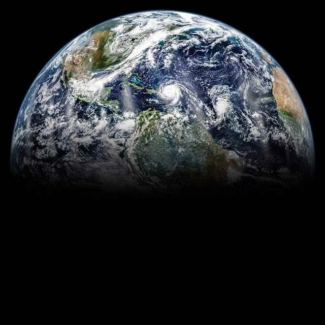
Earth and three hurricanes seen by Suomi NPP satellite
There was no shortage of storms brewing across the Atlantic basin in September 2017. On September 6, hurricanes Katia, Irma, and Jose lined up across the basin. The trio is visible in this image, captured that day by the Visible Infrared Imaging Radiometer Suite (VIIRS) on the Suomi NPP satellite. The image is a mosaic, assembled from images acquired throughout the day during several orbits of the satellite.
On September 6, Katia had strengthened over the southwestern Gulf of Mexico and was upgraded from tropical storm to hurricane status. The eye of Irma, a raging category 5 storm, passed north of Puerto Rico but still delivered strong winds and rain the Caribbean island. Meanwhile, Jose spun in the central Atlantic Ocean, and was also upgraded that day from a tropical storm to hurricane.
The bright strips are reflected sunlight, or “glint,” which show up over ocean areas in the middle of each orbit.
Image Credit: NASA Earth Observatory
Explanation from: https://earthobservatory.nasa.gov/NaturalHazards/view.php?id=90918


Comments
Post a Comment